Geoscience Consulting & Mapping Products
PRECISION.
INTELLIGENCE.
DISCOVERY.
Coast Map Labs delivers unmatched geoscience consulting and premium mapping products — from utility infrastructure to precision agriculture, trail systems to the Holy Lands.
01 — Consulting Services
UNMATCHED
GEOSCIENCE
CONSULTING
Our consulting practice spans the full geoscience value chain — from initial program architecture through delivery and stakeholder engagement. We bring 20+ years of expertise to every engagement, translating complex spatial data into actionable business intelligence.
Featured Use Case
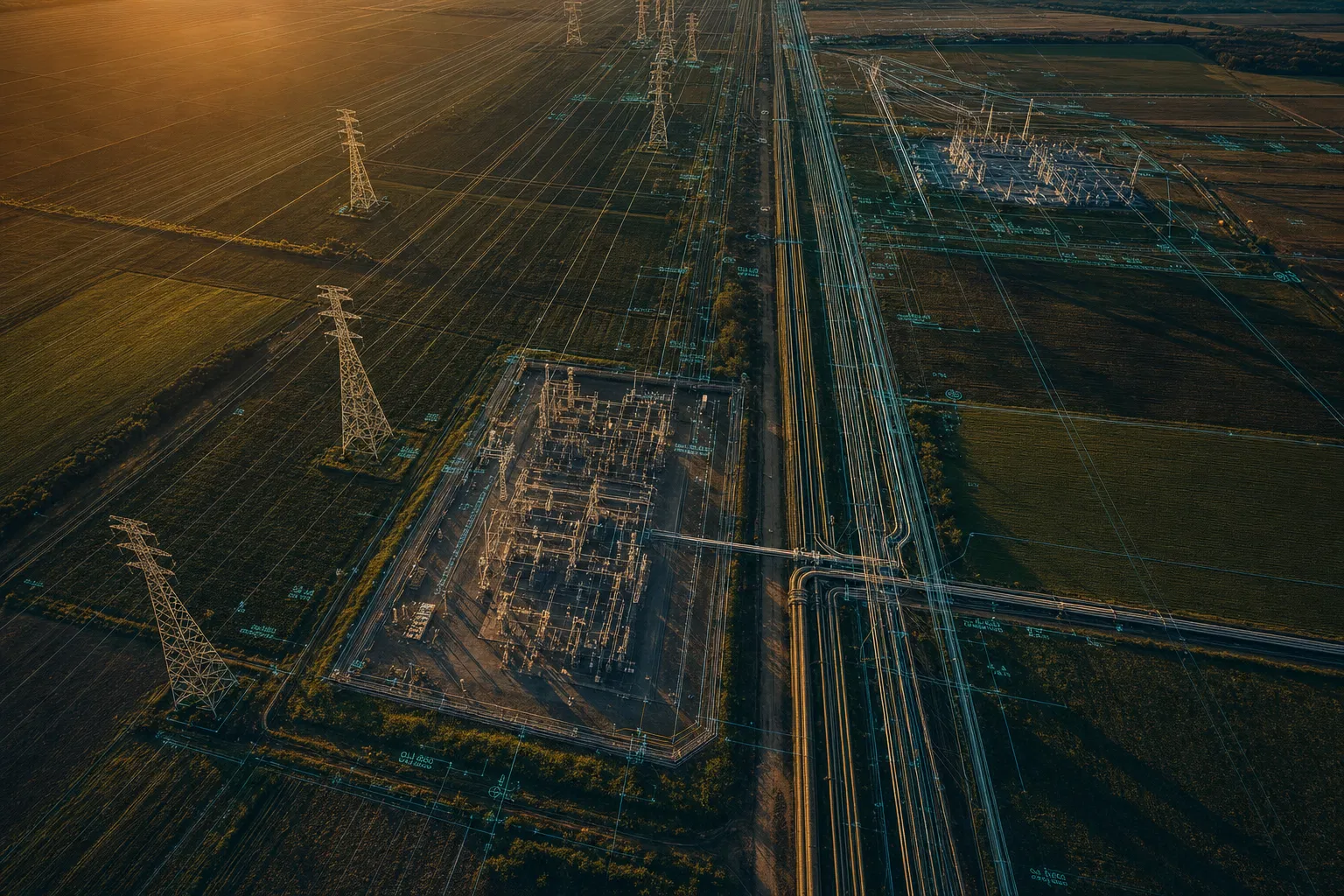
Utility Asset Management
Program Design
Architecting geoscience programs from first principles — aligning technical precision with strategic business outcomes.
Program Management
End-to-end delivery leadership for complex multi-stakeholder geospatial initiatives, on time and on scope.
Stakeholder Engagement
Bridging technical teams, executives, regulators, and communities through expert facilitation and communication.
Utility Asset Management
GIS-powered asset lifecycle management for electric, gas, water, and telecom infrastructure networks.
Precision Agriculture
Satellite and drone-derived spatial intelligence for crop health, yield optimization, and sustainable farming.
Trail Design Systems
Comprehensive trail network planning, terrain analysis, and environmental impact mapping for land managers.
02 — Map Products
MAPS THAT
TELL STORIES
From contemporary precision agriculture maps to museum-quality historical cartography — our products blend scientific rigor with artistic excellence.
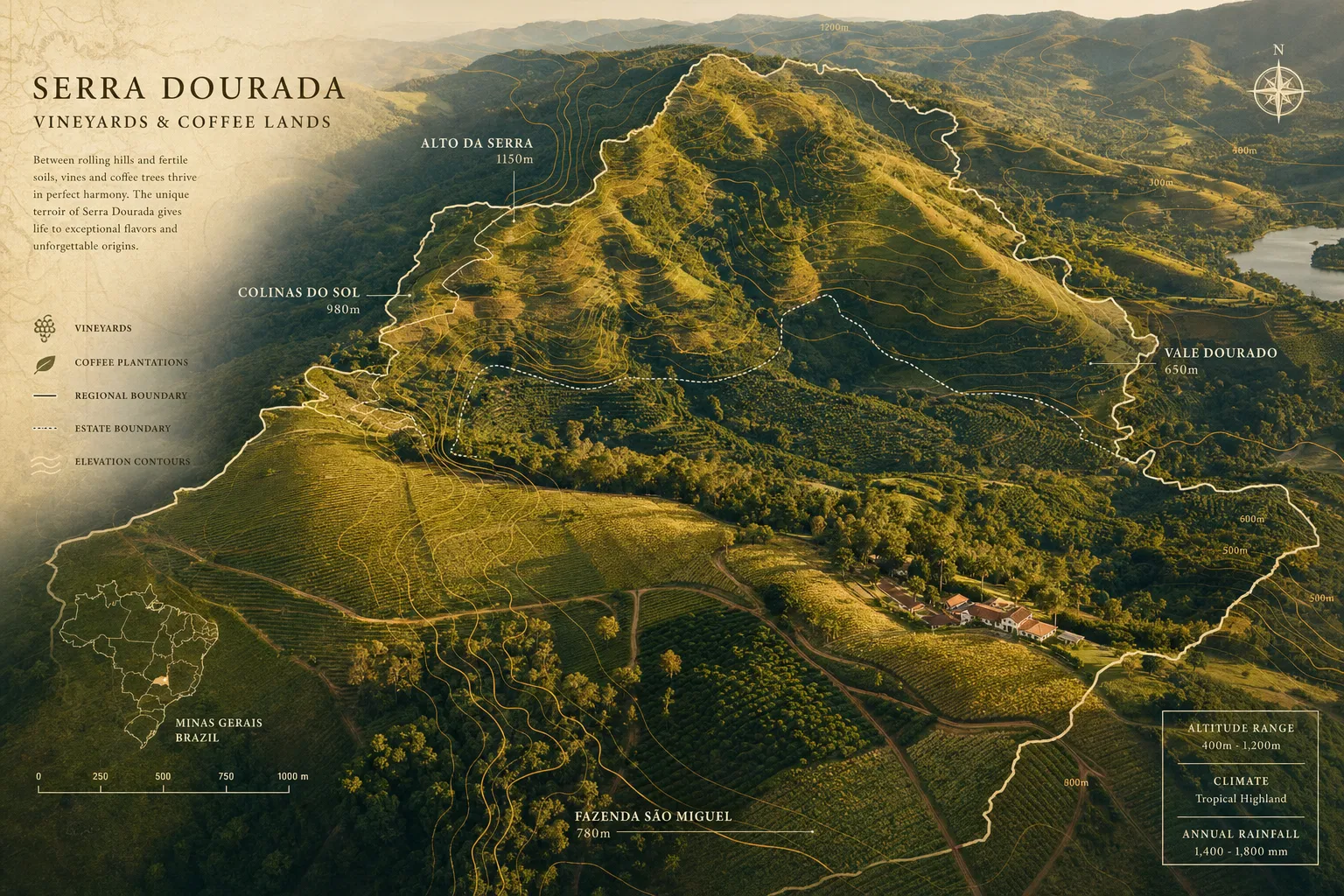
Agricultural Heritage
Coffee & Wine Region Maps
Contemporary and historical cartography of the world's premier growing regions — from Napa to Yirgacheffe.
EXPLORE COLLECTION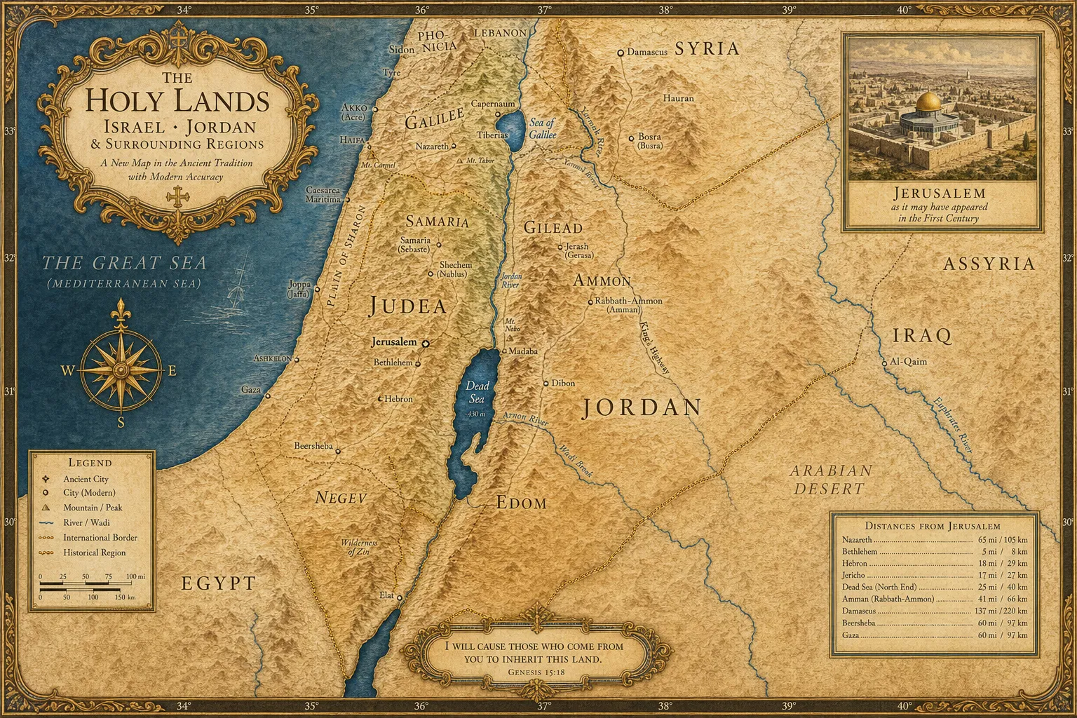
Historical Cartography
The Holy Lands Collection
Museum-quality maps of Israel, Jordan, and the surrounding regions, blending ancient tradition with modern accuracy.
EXPLORE COLLECTION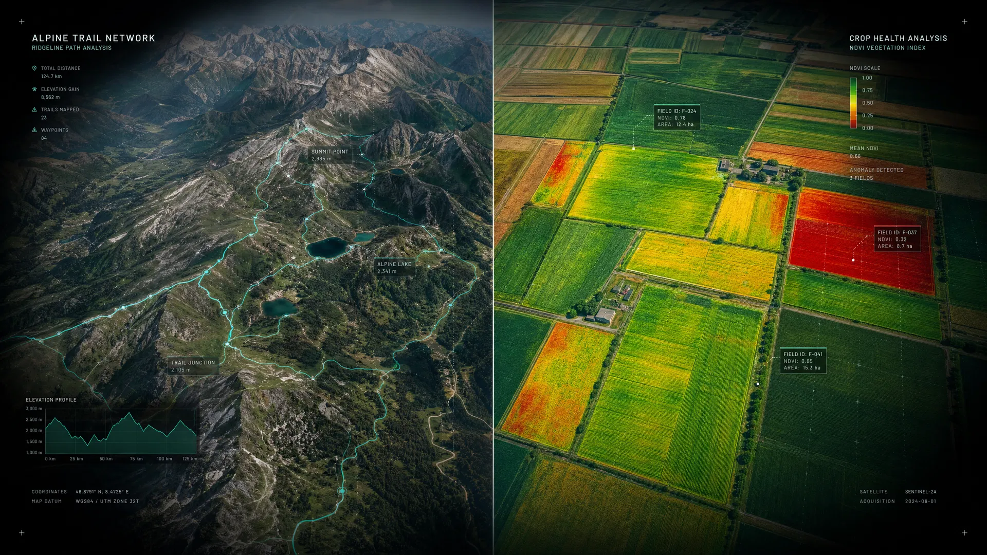
Applied Geoscience
Environmental & Community Maps
Custom mapping products for land trusts, municipalities, conservation organizations, and community planners.
EXPLORE COLLECTION03 — Use Cases
FROM TRAILS TO
TRANSMISSION LINES
Five verticals. One unwavering commitment to spatial intelligence that drives real-world outcomes.
View All Use Cases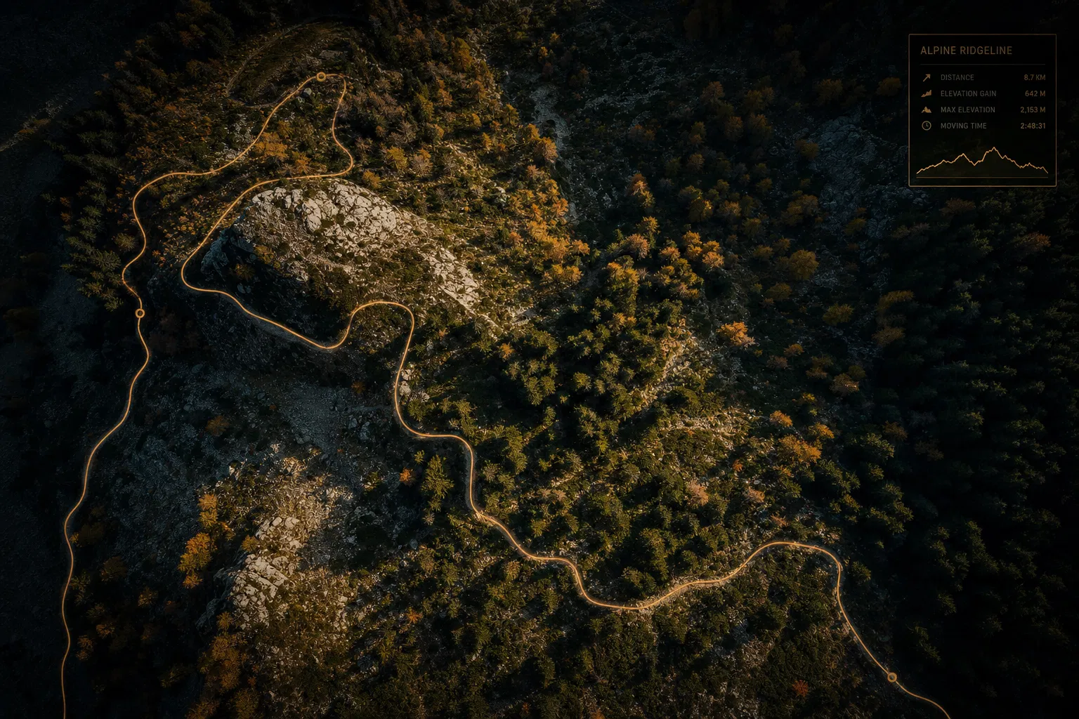
Trail Design Systems
"Terrain intelligence that shapes exceptional trail experiences"
We combine LiDAR terrain analysis, ecological sensitivity mapping, and stakeholder engagement to design trail networks that are sustainable, accessible, and extraordinary to use.
The Challenge
Land managers face mounting pressure to expand recreational access while protecting sensitive ecosystems, managing erosion risk, and meeting ADA compliance requirements — all with limited budgets and staff.
Our Approach
Coast Map Labs delivers end-to-end trail design support: high-resolution terrain modeling from LiDAR data, slope and aspect analysis, vegetation and soil sensitivity mapping, alignment optimization, and full regulatory documentation packages.
Outcomes Delivered
- Optimized trail alignments that minimize environmental impact
- ADA-compliant accessible route identification
- Erosion risk scoring and mitigation planning
- Stakeholder-ready visualization and engagement materials
- Permit-ready environmental documentation
Ready to explore what Trail Design Systems could look like for your organization?
Start Your Project
READY TO MAP YOUR
NEXT CHALLENGE?
Whether you need a custom consulting engagement, a bespoke map product, or a full enterprise GIS integration — our team is ready to deliver.
WE VALUE YOUR PRIVACY
We use cookies and similar technologies to operate this website, remember your preferences, and — with your consent — collect anonymized analytics to improve our content. We never sell your data. Privacy Policy